Beacon photo page's by Johan Veldhuis.
www.aerobeacons.nl
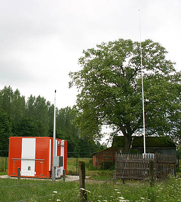
LOM OP, Brussel, 1 June 2006
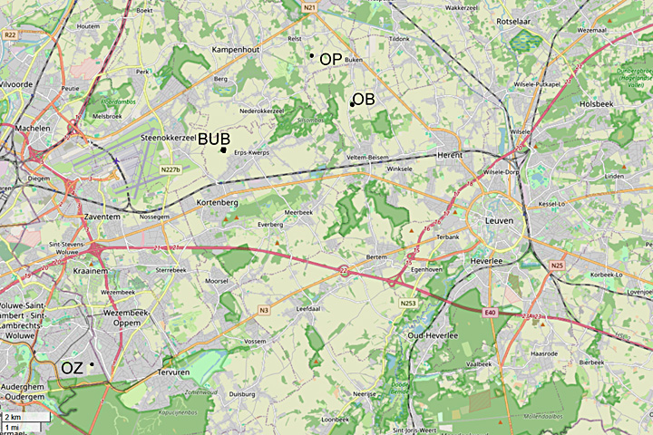
This beacon is located at the village of Wijder not far from the road Leuven to Mechelen. It is at the Paddensijpstraat 2.
We came from the beacon OB and drove direction Buken and from there to Wilder.
At Wilder we followed the Balkestraat and turned left into the Stokstraat.
This is a road for cyclist and local traffic only!
The Stokstraat bents to the left and then to the right.
At the bent to the right there is a road straight on with cobblestones.
That road is the Paddesijpstraat on which you find the beacon.
MapQuest says that it is possible to reach the Paddesijpstraat also from the opposite side,
but I doubt that.
Before the translation I looked at Google Earth
and at most there is a farm track between the to parts of this street
and it looks like a bad option to go over this track to the beacon.
This beacon is not in the GEN 2.5 list of 2024.

LOM antenna OP, panorama.

LOM OP, 1 June 2006.

LOM OP, detail antenna foot.

The cobblestone road straight on goes to the beacon.


The cobblestone road - paddensijpstraat – and the road to the right - stokstraat.

Flying straight on over the beacon to the runway.

They are building a new fence. I think that nowadays it is not possible to came near to the beacon as we did.

Location beacons at Brussel, © openstreetmap.org