Beacon photo page's by Johan Veldhuis.
www.aerobeacons.nl
Castres Locator CVU, 26 July 2007.
It is said that a picture can say more than 1000 words.
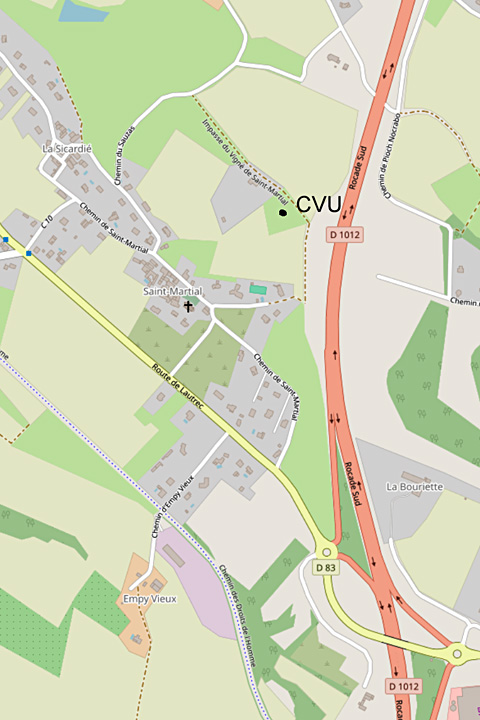
This is also the case with this beacon. That is why there is a map on this page.
The ring road northwest of Castres - D1012 - was not yet finished on Google Earth in 2007.
In reality it did exist and Wim traveled from the north over this road near the beacon.
Here, at the hill where the beacon is located - clearly visible from the north -
you take the exit and at the roundabout take the D83 - first exit to Saint-Martial.
Immediately turn right again, onto a narrow and steep road, the Chemin de Saint-Martial.
Just outside the village a road goes to the right, then diagonally to the right
and then you follow another road to the right, which dead ends on the hill at the beacon.
According to the map you are now at an altitude of 273 meters.
Locator CVU, 26 July 2007.
The D1012 seen from the beacon.

© openstreetmap.org