Beacon photo page's by Johan Veldhuis.
www.aerobeacons.nl
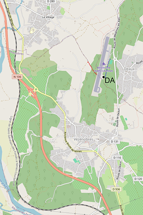
Locator DA, Ales Cevennes, 10 August 2009
Wim says:
After spending the night near Ales, I went hunting in good spirits.
The roads gradually became narrower, a good sign because the French preferred to place the beacon on the top of a hill.
Here I got stranded by car near a vineyard.
Miss Mio said that the beacon should be less than 200 meters away,
but the road took on the appearance of a dry riverbed with boulders.
Uphill on foot and at the top I was face to face with the runway!
On the other side of that is the beacon with the sun in the back. Oops.
Back to the car. That must be possible better.
Miss Mio instructed for a spot on the other side.
She wants to take dirt roads, I don't.
With a lot of effort I get to the other side of the airport and to a sturdy fence.
After a long walk on a path that runs parallel to the fence, I find an opening in the fence through which a path runs.
And hurray, 45 minutes after my first look at the beacon I am finally standing next to it with my camera.
Anyone who wants to visit this beacon would do well to first go to the east side of the airport, where the main buildings are also located. A handheld GPS is an easy tool here to find the beacon between the bushes.

Locator DA on the opposite side of the runway.


DA, but now on the right side of the runway.

Wim stood there first on the opposite side.

The path to follow along the fence.


© openstreetmap.org