Beacon photo page's by Johan Veldhuis.
www.aerobeacons.nl
Dijon VOR/DME DJL (VORTAC DIJ), 30 July 2007.
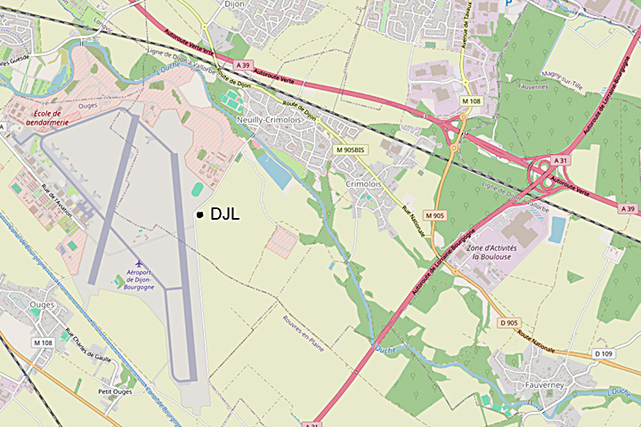
Hooray, a VORTAC. It is located on military grounds. And next to it the Ecole de Gendarmerie de Dijon. Complete with gendarmes who were already looking at the car with foreign inscriptions. And of course signs forbidding photography and forbidding entry. So put a 200mm lens on the camera and quickly take a picture from the car.
South of Dijon, just below the A39, Neuilly-les-Dijon is located on the D905. From the D905, enter Neuilly-l-D via the Allée des Marronniers. This makes a bend to the left that flows into a bend to the right - a small square on the left. Past this square the main route bends to the left again, the Rue de Général De Gaulle. On Google Earth you can now see that you are in the right place, the images on the right of the road are 'blocked out'. The name of the road changes to Chemin de Rouvres and you drive past barracks buildings. At the point where you are no longer allowed to continue, you will see the VORTAC in front of you.
Note: The beacon has changed names over time. The code DIJ referred to the VORTAC. In the Gen 2.5 of 2024, this beacon will be known as VOR/DME DJL.
VOR/TAC DIJ, 30 July 2007.

© openstreetmap.org