Beacon photo page's by Johan Veldhuis.
www.aerobeacons.nl
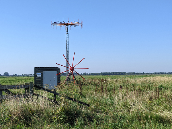
Nijkerk Direction Finder NYK, 12 August 2022.
Every now and then we receive a question about that antenna in Polder Arkemheen north of Nijkerk. Not so strange in itself because it is indeed related to aviation. However, it is not a beacon, but a direction finding antenna. Urs Keller took a picture of it and asked us what it meant. After our answer he asked further and received an extensive answer from the LVNL:
At the location you indicated is one of our radio direction finding stations. We call this VDF NYK. VDF stands for VHF (Very High Frequency) Direction Finder.
NYK stands for Nijkerk.
There are ten of these stations spread across the Netherlands. Five are at the airports controlled by LVNL (Schiphol, Rotterdam, Lelystad,
Groningen and Maastricht) and five at locations spread across the Netherlands including Nijkerk. But there is also a station on Texel, for example.
Operation
VDF NYK is, as you correctly conclude, a radio direction finding station with which we can locate radio transmissions from pilots.
It works as follows. As soon as a pilot seeks radio contact with air traffic control, that radio signal is picked up by multiple stations.
The direction finding station knows to a few degrees accuracy from which direction the radio signal is coming.
Another station that also picks up the radio signal also knows from which direction the signal is coming.
That information is sent to our head office at Schiphol at lightning speed and converted into what we call direction lines.
These are presented on the radar screens of our air traffic controllers.
The point where the lines intersect is the location of the aircraft.
The 'nicer' or clearer the intersection of two direction lines is, the clearer it is for the air traffic controllers.
The locations in the Netherlands have therefore been chosen in such a way that we can locate aircraft in the entire Dutch airspace as well as possible.
VDF NYK is centrally located and therefore a very suitable location.
Use
LVNL uses radars to determine the location of an aircraft.
The bearing line information is used as a tool to see the aircraft even faster.
Dutch airspace can be very busy and many aircraft are visible on the radar screens.
It helps if we can quickly see which aircraft is calling us.
A number of frequencies are used internationally for aircraft in distress. We also track those frequencies.
Replacement
In the course of next year we will replace the current system with a comparable new system.
The new antennas have already been installed. That is the antenna that you saw in the lowered position.
We cannot yet put this new antenna upright because it will disrupt the reception of our current system.
In the course of next year you will see that the new antenna is upright and the old mast is flat.
Due to technical developments, the new mast needs fewer antennas than the old one to determine the correct direction from which the transmission comes.
Our thanks to Urs Keller (and the LVNL) who sent us the photo and the explanation from the LVNL.

Direction Finder NYK, 12 August 2022. © photo Urs Keller
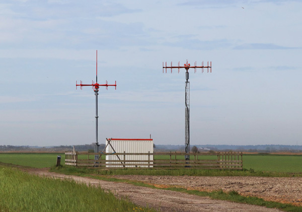
2024 Urs keller visited the last year the isles of Texel and made also a photo of the VDF there.

VDF at Texel, 05-05-2023. © foto Urs Keller